
For most of human history, navigating a city or a wilderness required an active engagement with the environment. You looked for the slope of the land, the direction of the wind, or the specific architecture of a street corner. Today, we have outsourced this cognitive labor to a glowing blue dot. While GPS provides unparalleled efficiency, it has fundamentally altered how we perceive space. We no longer build mental maps; we follow a sequence of turn-by-turn instructions. This shift isn't just a change in habit—it is a cognitive trade-off.
When we rely exclusively on satellite navigation, we stop performing the spatial calculations that keep the hippocampus—the brain's navigation center—sharp. Research indicates that active navigation engages the brain in ways that passive following does not. According to a landmark study on London taxi drivers, the process of learning the 'Knowledge' of the city's complex streets led to a physical increase in the volume of the posterior hippocampus (Source: Nature, 2011). By contrast, the modern commuter in Tokyo or New York often arrives at their destination with zero understanding of the route they just traveled. We are becoming spatially illiterate in an era of perfect information.

Prerequisites for Spatial Recovery
You cannot reclaim your mental map while the GPS is still running in your pocket. The protocol requires a deliberate removal of the safety net. The goal is not to abandon technology entirely but to rebuild the underlying skill set so that technology becomes a tool rather than a crutch. Before starting, you must accept that you will get lost. Getting lost is not a failure of the protocol; it is the primary mechanism of learning. The friction of being disoriented is exactly what triggers the brain to start mapping.
- A physical city map or a downloaded offline map (used only for verification)
- A traditional analog compass (optional but recommended for rural environments)
- A 'Navigation Partner' for high-stakes trips to ensure safety
- A notebook for sketching 'rough maps' of your movements
- The willingness to arrive ten minutes late
The Spatial Literacy Protocol
The protocol is a graduated process of cognitive re-engagement. We move from 'assisted awareness' to 'autonomous navigation.' The core objective is to shift your focus from the screen to the environment, forcing your brain to identify landmarks and establish directional vectors.
- The Pre-Trip Scan: Before leaving, study your map for five minutes. Identify the destination, the starting point, and at least three major 'anchor landmarks' along the way. Do not trace the route with your finger; instead, visualize the shape of the journey.
- The GPS Blackout: Turn off all navigation apps. If you are driving or walking, your only reference is the mental image you created during the scan. If you hit a crossroads, stop and ask: 'Where is the sun?' or 'Which way is the coast?'
- Environmental Anchoring: As you move, actively name landmarks. 'The red brick building with the clock,' or 'The intersection with the steep incline.' This creates a series of mental breadcrumbs that the brain can use to backtrack.
- The Triangulation Check: Every 15 minutes, stop and attempt to locate yourself on a physical map. Do not use your current location dot. Use the landmarks you've seen to triangulate your position. This forces the brain to translate visual cues back into a spatial grid.
- The Reverse-Route Challenge: On the return journey, do not use the same route. Attempt to navigate back using a different set of streets, relying on your understanding of the general cardinal directions (North, South, East, West) relative to your destination.
"The ability to create a cognitive map is not just about getting from point A to point B. It is about the fundamental human capacity to understand our place within a larger system. When we lose this, we lose a piece of our autonomy."— Institutional Perspective, Max Planck Institute for Human Cognitive and Brain Sciences
This process is significantly harder in modern 'non-places'—the sterile airports, shopping malls, and highway interchanges of Nairobi, Dubai, or Atlanta—where architecture is designed to be generic. In these environments, you must look for 'micro-landmarks.' A specific crack in the pavement, a unique sign, or the way the light hits a specific pillar. The more monotonous the environment, the more aggressive your observation must be.
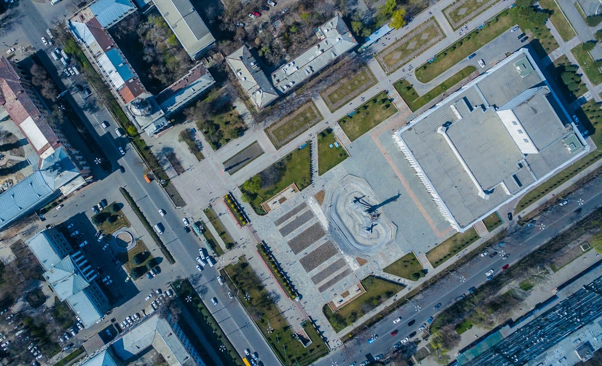
From a practitioner's perspective, the real debate in spatial navigation isn't about maps versus GPS—it is about 'route-following' versus 'survey-knowledge.' Route-followers know a sequence of turns; they are helpless if a single road is closed. Those with survey-knowledge understand the geometry of the city. In the field, we see this friction most clearly during urban crises or power outages. People with survey-knowledge adapt instantly, while route-followers experience total cognitive collapse because their external brain (the phone) has gone dark.
Common Pitfalls and How to Avoid Them
Most people fail the protocol because they succumb to 'the panic of the wrong turn.' The moment they realize they are lost, they immediately reach for the phone. This kills the learning process. The brain only builds a stronger map when it has to resolve a spatial conflict.
- The 'Panic-Ping': Checking the GPS the moment you feel slightly confused. Fix: Force yourself to walk for five more minutes before checking.
- Over-Reliance on a Single Landmark: Depending entirely on one tall building. If that building is obscured, you are lost. Fix: Identify at least three distinct markers per kilometer.
- Ignoring Cardinal Directions: Moving without knowing where North is. Fix: Use a compass or the sun to orient yourself every time you stop.
- The 'Linear Trap': Thinking of a city as a line instead of a grid. Fix: Practice 'lateral thinking' by intentionally taking parallel streets to see how they connect.
Ultimately, spatial literacy is a form of resilience. In a world where we are increasingly mediated by algorithms, the ability to look at a landscape and know exactly where you stand is a radical act of independence. It transforms travel from a passive consumption of coordinates into an active exploration of space. You stop being a passenger in your own life and start becoming the cartographer of your experience.
Fact-Check & Accuracy Note
The claims regarding hippocampal volume and the 'London Taxi' effect are sourced from the 2011 Nature study. The distinction between route-following and survey-knowledge is a standard framework in cognitive psychology and spatial navigation research. Note that individual results may vary based on prior spatial training and environmental complexity.