
The Myth of the Passive Perimeter
Do greenbelts actually protect the local economy? Most planners say yes. They are wrong. While these zones prevent sprawl, they often create an economic vacuum that starves the urban periphery. When a city draws a hard line in the dirt, it does not just stop concrete; it stops the flow of capital. This tension is no longer theoretical. In several global hubs, the rigid adherence to ecological buffers is being challenged by the sheer weight of population pressure and the need for commercial vitality.
Take Bhubaneswar. For years, the city maintained a strict 1 km construction buffer to protect sensitive areas like Nandankanan and Chandaka. Then came 2022. The removal of this buffer signaled a hard turn in how the city views its edges (Source: The SPA Journal of Planning and Architecture, 2026). The result was immediate. Land-use pressure spiked. The conflict between the need for commercial space and the requirement for flood resilience became a daily struggle for local developers and residents alike.
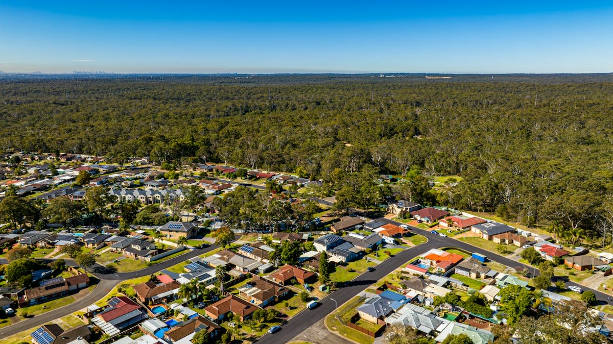
This is not just about buildings. It is about survival. The SPA Journal notes that while urban green spaces strengthen flood resilience, the intensity of human dependency on these ecosystem services varies wildly across different geographic buffers (Source: The SPA Journal of Planning and Architecture, 2026). When commerce is pushed out of the greenbelt, it does not disappear. It goes underground or becomes illegal. We see this in the rise of illegal logging and forest degradation that follows the easing of regulatory controls.
The Redevelopment Rebound
South Korea offers a different perspective on this struggle. In Anyang City, the trend is not about removing buffers but about aggressive redevelopment. Since May 2024, the city has seen a stop in population decline (Source: NamuWiki, 2024). Why? Because redevelopment projects are finally becoming visible. The city is betting that increasing housing and commercial density will trigger a rebound that lasts through 2026 (Source: NamuWiki, 2024).
Anyang's experience proves that economic vitality often requires a willingness to overwrite previous spatial constraints. The city previously held the title of the smallest area among general districts, a constraint that limited its commercial breath. By shifting its internal administrative grip and focusing on new apartment complexes and commercial hubs, the city is essentially trading static preservation for dynamic growth.
"The findings underscore the continued need for stronger regulatory controls and sustainable planning in a region where ecological degradation, climate risks, and increasing land-use pressure threaten the very systems on which local communities depend."— The SPA Journal of Planning and Architecture
Is this a gamble? Yes. But the alternative is a hollowed-out urban core. The delta between the strict conservation goals of 2020 and the redevelopment pushes of 2024 shows a clear trend. Cities are moving away from the 'fortress' model of greenbelts toward a more integrated, albeit riskier, model of coexistence.
The friction occurs in the gaps. For a practitioner, the real war is fought over 'digital boundaries.' In England, the 'Planning for the Future' white paper pushed for environmental and heritage data to be available digitally to reduce the need for site-specific surveys (Source: NPPF, 2020). On paper, this is efficiency. In reality, it creates a web of disputes between local councils who trust the digital map and developers who find the actual terrain contradicts the data (Source: Historic England, 2024).

This digital shift is critical. By 2030, England aims to have at least 200,000 ha of SSSI in AONBs in a favourable condition (Source: Historic England, 2024). To achieve this without killing local commerce, the data must be perfect. If the data is brittle, the regulations become an anchor that drags down local businesses, preventing them from expanding into viable spaces because of a misplaced digital line on a map.
The Data of Divergence
| Region | Key Shift | Timeline | Economic Driver |
|---|---|---|---|
| Bhubaneswar, India | Removal of 1km Buffer | 2022 | Urban Periphery Expansion |
| Anyang, South Korea | Redevelopment Push | 2024-2026 | Population Rebound |
| England, UK | Digital Data Transition | 2020-2024 | Survey Cost Reduction |
The numbers reveal a pattern of desperation. In Bhubaneswar, the removal of the buffer didn't just allow for shops; it invited illegal logging and forest degradation (Source: The SPA Journal of Planning and Architecture, 2026). This is the cost of rapid commercialization. When the regulatory dam breaks, the flood of development is often uncontrolled. The challenge is not whether to allow growth, but how to suture that growth into the existing environment without destroying the very ecosystem services—like flood resilience—that make the city livable.
We see a similar urgency in the UK. The goal for AONB management plans to be completed by 2024 is a race against time (Source: Historic England, 2024). If these plans are too restrictive, they kill the small-scale commerce that sustains rural villages. If they are too loose, the natural capital is eroded. The middle ground is narrow and increasingly difficult to maintain.
Fact-Check & Accuracy Note
The primary debate among urban planners focuses on the trade-off between 'ecosystem services' (like flood prevention in Bhubaneswar) and 'economic viability' (like population growth in Anyang). While the SPA Journal emphasizes community-centered approaches to assess dependency on these services, the actual implementation often falls victim to land-use pressure (Source: The SPA Journal of Planning and Architecture, 2026).
Ultimately, the trend is clear. The era of the 'static greenbelt' is ending. Cities are realizing that a rigid boundary is a brittle boundary. Whether through the removal of buffers in India, the aggressive redevelopment in Korea, or the digitalization of planning in England, the goal is the same: finding a way to grow without collapsing the environmental systems that support that growth.
Editorial Note
This analysis relies on current urban planning data from the SPA Journal (2026), NamuWiki (2024), and Historic England (2024). Note that 'population rebounding' in Anyang is a projection based on visible redevelopment projects moving into the 2025-2026 window.