'Massive rock avalanche likely caused Nepal flood'
Source Entity
GAURAV TALWAR
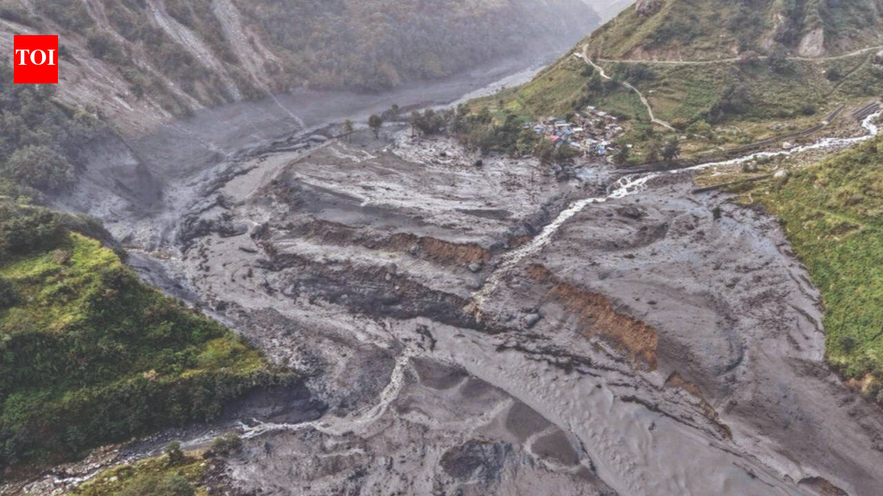
A massive rock avalanche in Nepal's Budhi Gandaki valley triggered a destructive flash flood, causing significant infrastructure damage and leaving five people missing. Scientific assessments suggest the disaster was fueled by debris from the Chamar massif, highlighting the increasing risks of mountain instability.
The Budhi Gandaki Disaster: An Analysis of Mountain Instability
A Sudden Catastrophe in the Himalayas
The recent flash flood in Nepal’s Budhi Gandaki valley represents a significant geological event that has left a trail of destruction, including damaged housing, compromised bridges, and ruined hydropower infrastructure. Preliminary scientific findings indicate that the primary driver of this disaster was a massive rock avalanche—potentially involving glacial ice—which created a temporary dam in the river before breaching, leading to the subsequent surge of water and debris. With five people currently reported missing, the incident underscores the volatile nature of high-altitude environments in the face of shifting climatic conditions.
Geological Origins and Scientific Assessment
According to experts like Professor Christian Huggel from the University of Zurich, the avalanche likely originated from the southern slopes of the Chamar massif. This region, characterized by peaks exceeding 7,000 meters, presents extreme logistical challenges for on-the-ground assessment. While cloud cover has hindered visual identification, satellite imagery and seismic signals suggest a catastrophic collapse of material, potentially amounting to several tens of millions of cubic meters. The inability to rule out the presence of glacial ice adds a layer of complexity to the incident, suggesting that thawing permafrost or glacial retreat may be contributing factors to slope instability.
Regional Context and Pattern Recognition
This event does not exist in a vacuum. Occurring just 46 days after the Rasuwa avalanche on August 26, which took place less than 100 kilometers away, the Budhi Gandaki flood highlights a concerning trend of increased seismic and geological instability in the region. The proximity of these two major events suggests that the high-altitude terrain of Nepal is currently experiencing a period of elevated risk. Whether these events are symptomatic of broader regional climate shifts or localized tectonic stress remains a subject of ongoing investigation.
Impact on Infrastructure and Local Communities
The destruction of hydropower infrastructure is particularly concerning for Nepal, a nation that relies heavily on its mountain rivers for energy production. The loss of bridges and housing not only disrupts the daily lives of local residents but also poses long-term economic challenges for remote communities that depend on these transit routes. The flash flood acts as a stark reminder of the vulnerability of mountain infrastructure to sudden, high-magnitude natural disasters that are difficult to predict with current early warning systems.
Future Trends and Resilience
Looking forward, the integration of satellite monitoring and seismic sensing will be critical in mitigating future risks. As mountain ranges like the Himalayas continue to undergo physical changes due to atmospheric warming, the frequency of rock and ice avalanches may increase. The scientific community faces the challenge of translating these complex geological signals into actionable alerts for vulnerable populations. The Budhi Gandaki event serves as a vital case study for developing more robust disaster management protocols in high-altitude environments, emphasizing the need for continued international cooperation in mountain hazard research.