Archie G. Norcross' Maine Forest Fire Maps (1918–22)
Source Entity
Hacker News
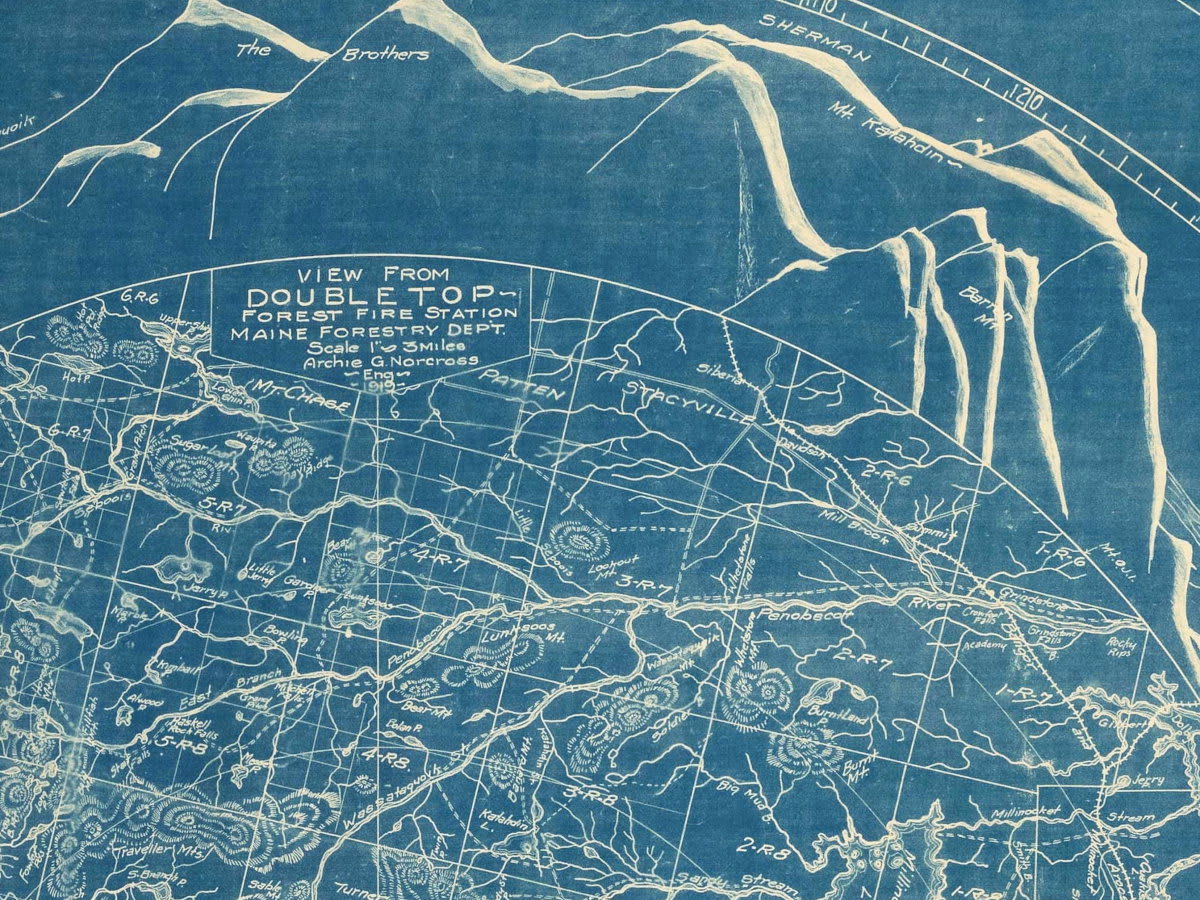
Archie G. Norcross documented Maine forest fire maps between 1918 and 1922. These historical records are currently being highlighted by the Public Domain Review (PDR) to support their non-profit mission.
The Historical Significance of Norcross' Forest Mapping
Archie G. Norcross’ work, spanning the years 1918 to 1922, serves as a critical historical record of forest fire patterns in Maine. During this early 20th-century period, the systematic mapping of forest fires was essential for land management and the protection of timber resources, which were vital to the regional economy. By documenting the spatial occurrence and reach of these fires, Norcross provided data that helped shape early conservation efforts and fire prevention strategies in the American Northeast.
Documenting the Maine Landscape
The maps produced by Norcross during this four-year window offer a window into the environmental challenges faced by Maine’s forestry services. At the time, forest management was transitioning toward more scientific approaches, and the ability to track fire frequency was a cornerstone of this evolution. These documents are not merely administrative records; they are artifacts of a period where human settlement and industrial activity began to intersect more intensely with wildland areas, necessitating rigorous monitoring.
The Role of Public Domain Review
The Public Domain Review (PDR) has brought these specific maps into the public consciousness as part of its mission to curate and share historical documents. By highlighting such niche collections, the PDR emphasizes the value of archival preservation. This project underscores how historical data, once confined to state archives or private collections, can be revitalized for educational purposes in the digital age.
A Non-Profit Model for History
The dissemination of these maps is supported by a non-profit model that relies heavily on community engagement rather than traditional advertising or paywalls. This approach to archiving history reflects a broader trend in the digital humanities, where institutions seek sustainable ways to provide open access to cultural heritage. By soliciting donations and offering thematic rewards, projects like the PDR maintain the integrity of their content while fostering a community of supporters.
Broader Implications and Future Trends
The focus on Norcross' work highlights a growing interest in environmental history and the digitization of geographic records. As we look toward the future, the integration of historical fire data with modern geospatial technology allows researchers to better understand long-term ecological changes. While the maps themselves are specific to Maine, the model of preserving and sharing them serves as a blueprint for how other historical archives might be managed in an era of digital democratization and non-profit advocacy.