Andhra Pradesh, Tamil Nadu on alert as cyclone ‘Murasu’ looms
Source Entity
Latest News: Todays Latest News Headlines from India & World | Hindustan Times
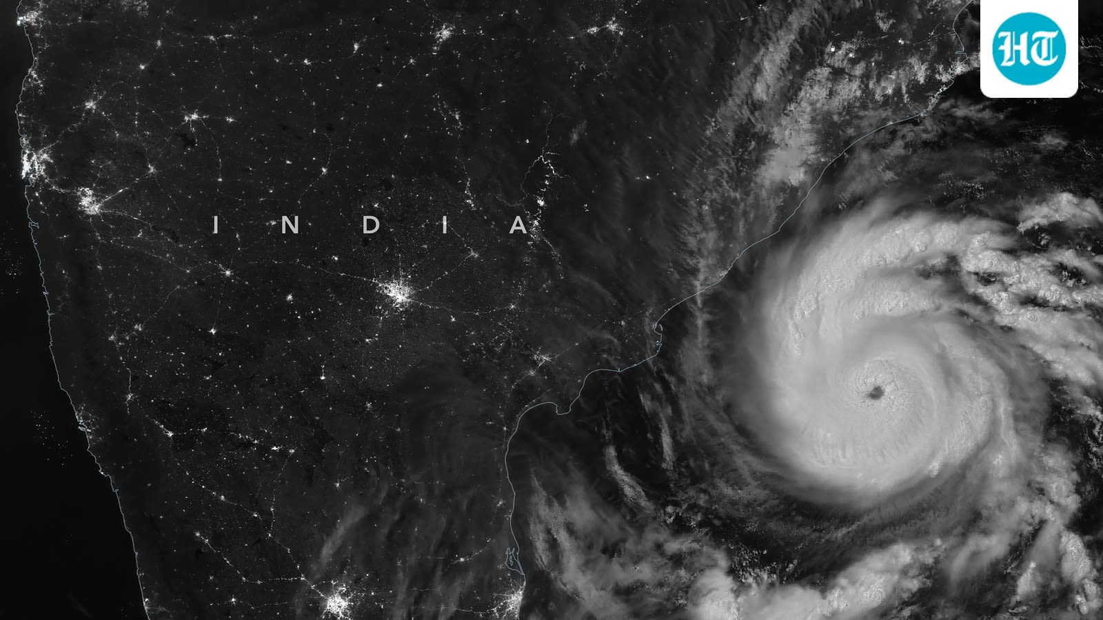
A new weather system in the Bay of Bengal is intensifying into a cyclonic storm, expected to bring heavy rain to Andhra Pradesh and parts of the Southern Peninsula. While the system will impact coastal regions, experts anticipate it will weaken significantly before reaching inland areas like Telangana.
Meteorological Development in the Bay of Bengal
The India Meteorological Department (IMD) has identified a significant weather system currently developing over the South Andaman Sea and the surrounding Andaman and Nicobar Islands. Initially forming as a low-pressure area, the system is rapidly intensifying, with projections indicating a transition into a depression and subsequently a cyclonic storm. This development represents a notable shift in regional weather patterns following a brief period of respite, signaling the resumption of active rainfall across the Southern Peninsula.
Trajectory and Intensification
According to the latest technical assessments from the IMD, the system is tracking in a west-northwestward direction. Meteorological models suggest that the storm will reach the west-central Bay of Bengal by the evening of November 2, 2026. The primary concern remains the coastal belt of Andhra Pradesh, which is expected to bear the brunt of the system as it moves toward the coast, with landfall anticipated by the morning of November 3.
Impact on Keralam and Southern India
Keralam is set to experience a revival of rainfall activity starting November 1, 2026, directly attributed to the moisture influx from this Bay of Bengal system. The interaction between the advancing weather system and the local topography of the Southern Peninsula is expected to result in heavy precipitation. Residents and local authorities in these regions have been advised to monitor updates as the atmospheric conditions evolve over the coming days.
Inland Weakening and Regional Variations
While the system is expected to reach cyclonic intensity over the sea, its impact on inland geography is forecast to be less severe. S. Stella, Head of the IMD Centre in Hyderabad, has clarified that the system is likely to weaken considerably into a deep depression before it reaches Telangana. This highlights the typical behavior of cyclonic systems, which lose energy rapidly once they move away from the warm waters of the ocean and encounter land-based friction.
Broader Implications and Preparedness
This cycle of storm development underscores the heightened vulnerability of the Bay of Bengal to cyclonic activity during this post-monsoon window. The succession of storms—coming shortly after previous disturbances like Cyclone Arnab—strains regional disaster management resources. The forecast of heavy showers across nine districts in Telangana, even in a weakened state, necessitates proactive drainage management and disaster preparedness to mitigate potential waterlogging or infrastructure damage.
Conclusion
In summary, the transition of the low-pressure area into a cyclonic storm serves as a reminder of the dynamic weather patterns influencing the Indian coastline. While coastal Andhra Pradesh faces the most direct threat of severe weather, the surrounding states, including Keralam and Telangana, will experience varying degrees of meteorological impact. Continuous vigilance and adherence to IMD advisories remain the best defense against the unpredictable nature of these tropical systems.
Multiple Citing Sources
Verification Required?