European Union grants US request to restrict satellite images of Iran War region
Source Entity
Jeremy Hsu
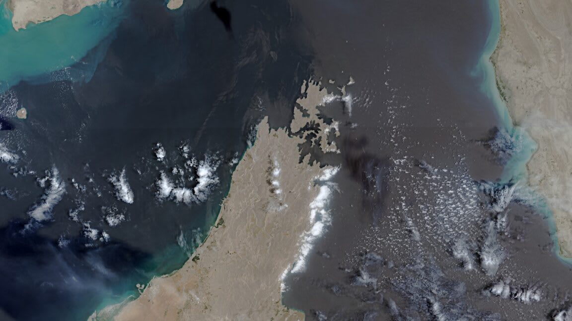
The European Union has implemented a 24-hour delay on satellite imagery of the Strait of Hormuz following a request from the United States. This restriction on the Copernicus program impacts critical shipping lanes amidst rising tensions between the US and Iran.
Strategic Restrictions on Satellite Data in the Strait of Hormuz
The decision by the European Union to impose a 24-hour delay on the release of satellite imagery covering the Strait of Hormuz represents a significant departure from the traditionally open-access policy of the Copernicus Earth observation program. By restricting data from the Sentinel-1 and Sentinel-2 satellites, the EU has effectively altered the transparency of one of the world's most critical maritime chokepoints. This shift, initiated following a formal request from the United States government on May 26, underscores the intersection of satellite technology, global security, and geopolitical maneuvering.
The Geopolitics of Maritime Surveillance
The Strait of Hormuz serves as a vital artery for global energy markets, with a significant percentage of the world's oil transiting through its waters. Consequently, the region is a focal point for military surveillance and intelligence gathering. The US government’s push to restrict publicly available imagery suggests a desire to manage the information flow surrounding ongoing military activities and shipping security in the Gulf of Oman. By delaying the availability of high-resolution satellite data, stakeholders can effectively create a window of operational ambiguity, potentially preventing non-state actors or hostile entities from utilizing real-time monitoring to anticipate or react to maneuvers.
Impact on the Copernicus Program
Europe’s Copernicus program has long been lauded for providing free and open access to Earth observation data, fostering scientific research, environmental monitoring, and commercial innovation. The sudden policy change, formalized by the Council of the EU on July 13, marks an unusual intervention in this mandate. While the restriction is geographically limited to the Gulf of Oman, it raises questions regarding the future of 'open data' policies when faced with national security pressures from allied nations. The precedent set here could lead to further compartmentalization of satellite data in other contested regions.
Escalating Tensions and US-Iran Relations
The timing of this policy shift coincides with a period of heightened friction between the United States and Iran. The Trump administration's strategy, characterized by the ramping up of pressure on Iran, has necessitated a higher degree of control over information warfare. By limiting the public's ability to monitor shipping lanes through satellite imagery, the US aims to maintain tactical superiority and prevent the public disclosure of sensitive military movements or potential incidents that could further destabilize the region.
Long-term Implications for Global Security
This development highlights the growing reality that satellite imagery is no longer just a tool for environmental study but a high-stakes asset in modern conflict. As nations continue to integrate space-based assets into their defense strategies, the ability to selectively restrict or delay data will likely become a common diplomatic tool. The international community will need to grapple with the balance between the benefits of open scientific data and the perceived necessity of security-driven censorship, especially as the technology for high-resolution imaging becomes increasingly accessible to the public.
Concluding Observations
The EU's decision to accommodate the US request reflects the deepening influence of security concerns over the established norms of information sharing. As the situation near the Strait of Hormuz remains volatile, the 24-hour delay on Copernicus imagery serves as a tactical measure to control the narrative and operational visibility in a theater defined by uncertainty. Moving forward, the global community must monitor whether this restriction remains a temporary measure or becomes the precursor to a more guarded era of satellite data management.