The OlmoEarth Platform: Geospatial inference at planetary scale
Source Entity
Hugging Face - Blog
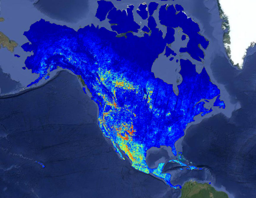
The Allen Institute for AI (Ai2) has launched the OlmoEarth platform, a suite of foundation models trained on 10 terabytes of satellite data. This initiative aims to democratize geospatial inference for environmental monitoring, including deforestation, food security, and wildfire prevention.
The Emergence of OlmoEarth: A New Era for Geospatial AI
On July 28, 2026, the Allen Institute for AI (Ai2) unveiled the OlmoEarth Platform, representing a significant advancement in the application of artificial intelligence to Earth observation. By leveraging approximately 10 terabytes of multimodal satellite data, these foundation models are designed to process and interpret planetary-scale geospatial information with unprecedented depth and accuracy.
Scaling Environmental Intelligence
The core strength of the OlmoEarth models lies in their ability to perform complex geospatial inference. By training on such a massive, diverse dataset, the models can identify nuanced patterns across the Earth's surface that would be impossible to detect manually. This capability is currently being harnessed by governments, non-governmental organizations (NGOs), and mission-driven entities to address critical environmental challenges such as tracking deforestation, ensuring food security, and assessing wildfire risks.
Bridging the Engineering Gap
Historically, the barrier to entry for utilizing high-end AI models in the environmental sector has been substantial. While Ai2 has a proven track record of releasing powerful open-source models, the reality is that many mission-driven organizations lack the necessary computational infrastructure or specialized engineering teams to deploy these tools effectively. OlmoEarth is designed to address this specific friction point, shifting the focus from model creation to practical, actionable application.
Implications for Global Conservation
The implications of this platform are far-reaching. By providing a foundation model that can be adapted for specific regional or thematic needs, Ai2 is essentially democratizing access to high-level remote sensing analysis. Whether it is monitoring illegal logging in the Amazon or predicting crop failure in drought-prone regions, the platform offers a standardized technological backbone for global sustainability initiatives.
Future Trends in Earth Observation
Looking forward, the success of OlmoEarth suggests a trend toward the 'commoditization' of geospatial intelligence. As these models become easier to integrate, we can expect a surge in data-driven environmental policy. The ability to move from raw satellite pixels to actionable insights at scale will likely become the standard requirement for any organization involved in large-scale land management or climate mitigation.
Conclusion
The launch of the OlmoEarth platform marks a pivotal shift in how we utilize AI for ecological preservation. By mitigating the engineering overhead typically associated with deep learning in geospatial analysis, Ai2 is empowering the organizations best positioned to effect change. As the platform matures, it will undoubtedly serve as a critical tool in the global effort to monitor and protect our planet's most vulnerable ecosystems.