25% of flood-hit districts inaccessible: Assam CM
Source Entity
India Latest News: Top National Headlines Today & Breaking News | The Hindu
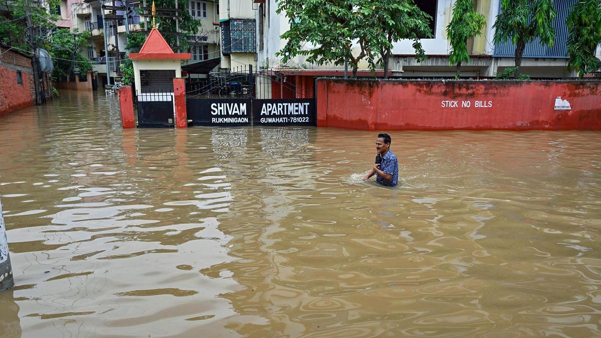
Assam faces a severe flood crisis with over 11 lakh people affected and 61 fatalities reported. Chief Minister Himanta Biswa Sarma noted that 25% of flood-hit areas in Sivasagar and Charaideo remain inaccessible, complicating rescue operations.
The Expanding Crisis in Assam: A Deep Dive into the 2026 Deluge
Assam is currently grappling with one of its most challenging natural disasters in recent years. As of July 24, 2026, the state is reeling from an unprecedented deluge that has claimed 61 lives since mid-June. Chief Minister Himanta Biswa Sarma has highlighted the severity of the situation, noting that roughly 11 lakh people have been impacted across more than 2,000 villages. The sheer scale of the displacement is evidenced by the 41,000 citizens who have been forced to seek refuge in state-run relief camps.
The Challenge of Inaccessibility
One of the most critical issues currently hindering disaster response is the physical inaccessibility of affected regions. Specifically, in the districts of Sivasagar and Charaideo—which share borders with Nagaland—approximately 25% of flood-hit areas remain cut off from relief efforts nearly a week after the initial deluge. This geographical isolation poses a significant threat to the delivery of essential supplies, medical aid, and search-and-rescue operations, potentially exacerbating the human toll in these remote zones.
Discrepancies in Data and Disaster Management
While the Chief Minister’s assessment underscores the widespread nature of the crisis, reports from the Assam State Disaster Management Authority (ASDMA) provide a more localized perspective. The ASDMA indicates that 7.05 lakh people are affected across 856 villages in 12 districts. Such variations in reporting often occur during active disaster management when data collection is impeded by the very floods being measured. These statistics emphasize the dynamic and fluctuating nature of the floodwaters, which continue to threaten infrastructure and livelihoods across the state.
Historical Context and Environmental Vulnerability
Assam’s topography, dominated by the Brahmaputra River system, makes it historically susceptible to annual flooding. However, the current intensity suggests an escalation in the severity of monsoon events. The concentration of fatalities in Jorhat, Sivasagar, and Charaideo points to a specific regional vulnerability where heavy rainfall in the upstream catchment areas quickly translates into catastrophic flooding in the plains. This recurring cycle necessitates a long-term strategic review of flood-resilient infrastructure in these specific districts.
Future Trends and Resilience Strategies
Looking ahead, the government faces the dual challenge of immediate humanitarian relief and long-term mitigation. The high number of displaced individuals residing in relief camps indicates a critical need for sustained resources to prevent the spread of waterborne diseases and ensure food security. As climate patterns become increasingly unpredictable, the state will likely need to integrate satellite-based monitoring and drone technology to reach the 25% of areas that remain inaccessible, ensuring that no village is left behind during future monsoon cycles.
Verification Required?