Google-backed satellites for wildfire detection launch as smoke chokes US, Canada
Source Entity
Jeremy Hsu
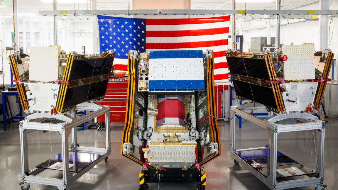
The Google-backed FireSat program has launched its first three microsatellites to enhance global wildfire detection. These satellites provide high-resolution monitoring, aiming to spot fires early across the U.S., Europe, and Australia.
A New Frontier in Wildfire Detection
As the North American continent grapples with the escalating reality of widespread wildfire smoke, the successful launch of the FireSat program represents a critical technological pivot. On July 7, 2026, a SpaceX Falcon 9 rocket carried the first three operational microsatellites from Vandenberg Space Force Base, marking a shift toward real-time environmental monitoring. Managed by the Earth Fire Alliance, this constellation is specifically engineered to identify wildfires that traditional satellite arrays often overlook, offering a vital new tool for emergency responders.
The Technological Advantage of FireSat
The core innovation of the FireSat initiative lies in its specialized sensing capabilities. Unlike legacy satellite systems that may have lower resolution or longer revisit times, these microsatellites are designed to detect fires while they are still small and manageable. By providing granular data, the system aims to close the gap between fire ignition and official detection, fundamentally changing how fire agencies approach containment strategies in the United States, Australia, and Europe.
Operational Timeline and Global Impact
The transition to 'initial operational capability' follows a rigorous developmental phase. With the satellites now in orbit, a three-month testing period will ensure that the hardware is calibrated for high-stakes environmental observation. Once fully operational by the end of the year, the constellation will provide comprehensive, twice-daily coverage of the world’s most fire-prone regions, effectively creating a global early-warning network for wildfire activity.
Bridging the Gap in Emergency Management
Historically, forest management and emergency response agencies have relied on a combination of ground-based sightings and generalized satellite imagery, both of which can be delayed by cloud cover or remote topography. FireSat serves as a force multiplier for these existing methods. By feeding data directly to fire agencies, the program enables more precise resource allocation, potentially saving vast swaths of land and infrastructure from the devastating impacts of unchecked blazes.
Future Trends in Climate Resilience
As wildfire seasons become longer and more intense due to changing global weather patterns, the reliance on space-based infrastructure will likely grow. The FireSat project is a prime example of a public-private partnership, combining Google's data processing and backing with specialized nonprofit management. This model could set a precedent for how future climate-focused technology is developed, deployed, and scaled to meet the needs of a warming planet.
Conclusion
The launch of these first three satellites is more than just a successful rocket mission; it is a vital step toward creating a robust, global defense against the increasing threat of wildfires. By integrating advanced satellite technology into the daily operations of fire management agencies, the FireSat program promises to turn the tide in the race to detect and contain fires before they become catastrophic events.