ISRO timelapse video captures Cyclone Arnab's movement towards Andhra coast
Source Entity
Latest News: Todays Latest News Headlines from India & World | Hindustan Times
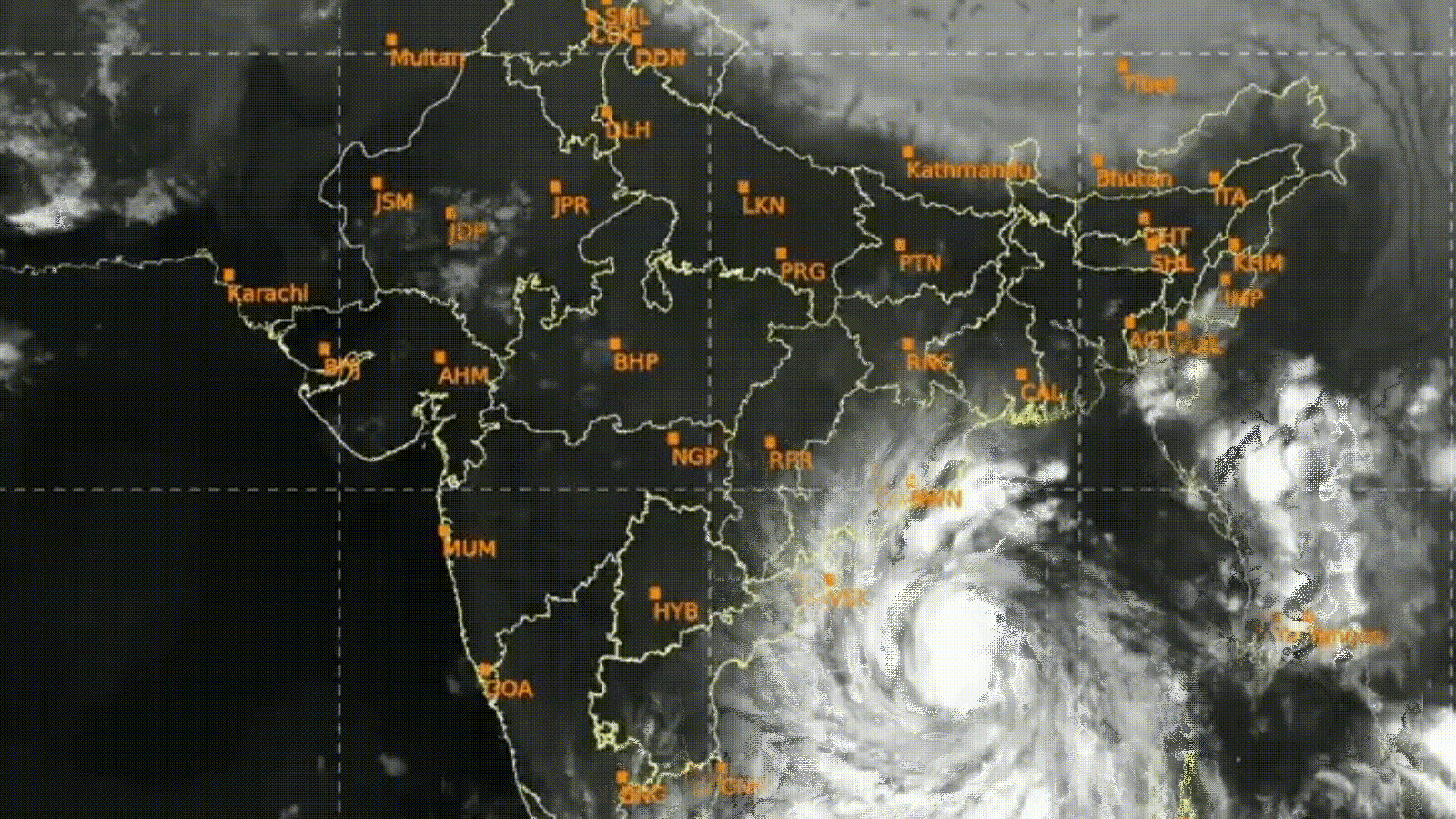
Cyclone Arnab has made landfall in Andhra Pradesh, bringing destructive winds and heavy rainfall to coastal districts. The India Meteorological Department had previously tracked the system's intensification from a low-pressure area to a severe cyclonic storm.
The Progression and Impact of Cyclone Arnab
The Indian subcontinent is currently grappling with the aftermath of Cyclone Arnab, a weather system that evolved rapidly from a low-pressure area in the Bay of Bengal into an extremely severe cyclonic storm. The India Meteorological Department (IMD) initially identified a low-pressure formation over the east-central and southeast Bay of Bengal, which systematically intensified into a depression, then a deep depression, and finally a cyclonic storm as it tracked west-northwest toward the coast.
Meteorological Evolution and Warnings
Before making landfall, the IMD issued critical warnings regarding the storm's trajectory. Meteorological projections indicated that the system would target the North Andhra Pradesh and South Odisha coasts. Authorities issued red alerts for extremely heavy rainfall between October 27 and 29, anticipating the severe impact of wind speeds reaching up to 145 kmph and potential storm surges of 1 to 2 meters. These early warnings were vital in advising fishermen to return to shore and mobilizing disaster response teams.
Landfall and Immediate Consequences
Cyclone Arnab officially made landfall between Kakinada in Andhra Pradesh and Yanam in Puducherry. The impact was immediate and severe, with wind speeds clocked between 125 and 135 kmph. Districts including Kakinada, Konaseema, and West Godavari bore the brunt of the storm, experiencing widespread destruction characterized by uprooted trees and significant disruptions to electrical infrastructure, effectively paralyzing normal life in these regions.
Disaster Management and Response
As the landfall process began on Tuesday night, the Andhra Pradesh State Disaster Management Authority (APSDMA) assumed a critical role in monitoring the system's "eye." By Wednesday morning, authorities reported that the landfall process was ongoing, with relief efforts focused on mitigating the damage caused by the torrential rains and high-velocity winds. The synchronization between IMD forecasting and state-level disaster response remains a cornerstone of managing such high-intensity weather events in coastal India.
Broader Implications and Future Trends
This event highlights the increasing frequency and intensity of cyclonic activity in the Bay of Bengal, a trend often associated with changing climatic patterns. The ability of the IMD to track the system from a low-pressure area to a severe cyclone underscores the importance of advanced satellite monitoring and predictive modeling. As the region begins recovery, the focus will shift toward infrastructure restoration and long-term climate resilience, ensuring that coastal communities are better equipped to withstand the heightened volatility of future monsoon seasons.
Multiple Citing Sources
Verification Required?