Tornado in Howell, Michigan? Latest radar as Livingston County, Lansing, Brighton, Pinckney, Whitmore Lake under warning
Source Entity
Latest News: Todays Latest News Headlines from India & World | Hindustan Times | Hindustan Times
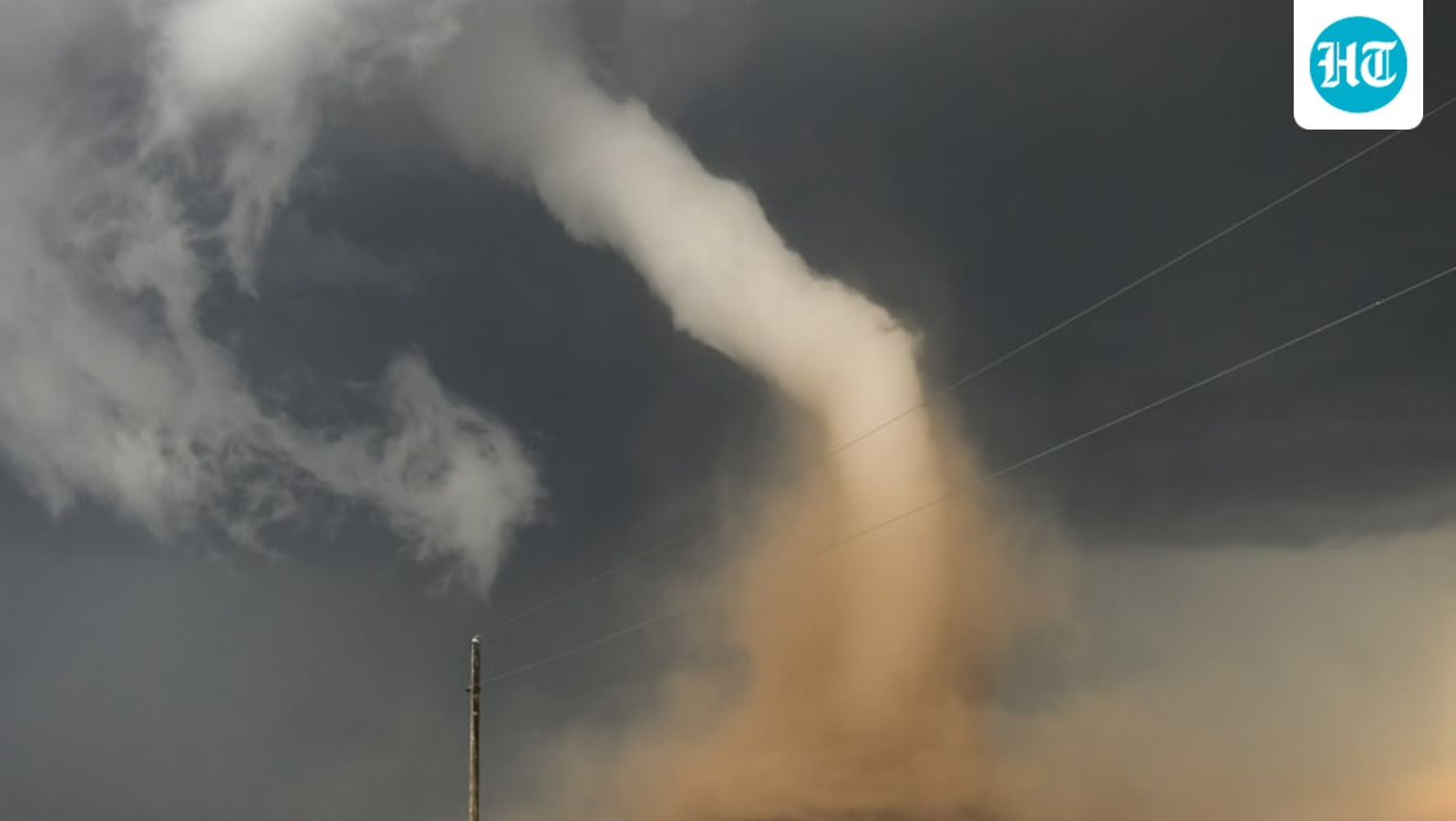
A radar-indicated tornado near Howell, Michigan, has prompted urgent warnings for multiple communities as it tracks toward Lansing at 60 mph. Storm chasers have captured visual confirmation of a wedge-shaped twister, leading to widespread safety alerts across Livingston County.
Severe Weather Event: Radar-Indicated Tornado Strikes Livingston County
A dangerous weather situation developed in Michigan today as a radar-indicated tornado was identified near Howell in Livingston County. The National Weather Service (NWS) promptly issued a tornado warning for several communities, including Fowlerville, Gregory, Pinckney, Brighton, and Whitmore Lake, as the system tracked rapidly toward Lansing. The speed of the storm, estimated at 60 miles per hour, necessitated immediate action from local emergency services and residents to ensure public safety.
Meteorological Context and Dynamics
According to NWS data, the storm system exhibited significant rotation, leading to the classification of a radar-indicated tornado. This phenomenon occurs when weather radar detects a mesocyclone—a rotating updraft within a supercell thunderstorm—which is the precursor to a confirmed tornado. The inclusion of pea-sized hail and heavy rainfall indicates a robust, high-energy environment that often accompanies severe convective storms in the Great Lakes region.
Visual Confirmation and Storm Chasing
Adding a layer of critical urgency to the NWS warnings, Michigan-based storm chaser Jaden Pappenheim successfully intercepted the system just south of Howell. Pappenheim captured photographic evidence of what appeared to be a wedge tornado, a term used to describe a twister that is at least as wide as it is tall. This visual confirmation corroborates the radar data and underscores the severity of the threat posed to the inhabitants of the path of the storm.
Public Safety and Warning Systems
The NWS warning, which remained in effect until 3:45pm EDT, serves as a vital reminder of the efficacy of modern meteorological forecasting. By identifying the rotation early and disseminating alerts to specific areas like Brighton and Whitmore Lake, officials provided residents with a narrow but essential window to seek shelter. The rapid movement of the storm at 60 mph illustrates the difficulty in tracking such events and highlights why immediate compliance with NWS warnings is non-negotiable for personal safety.
Broader Implications of Severe Weather
While Michigan is not typically associated with the high-frequency tornado activity seen in the Great Plains, these events are a poignant reminder that severe convective activity can occur anywhere given the right atmospheric conditions. The rapid transit of this storm toward Lansing suggests a highly unstable environment capable of producing significant wind damage. As climate patterns evolve, the frequency and intensity of such localized severe weather events remain a subject of intense focus for meteorologists and emergency planners.
Conclusion
The situation in Howell and surrounding areas serves as a stark example of nature's unpredictability. With visual confirmation from storm chasers and consistent radar warnings, the response from the Livingston County community was tested under high-pressure conditions. As the warning window closes, the focus shifts to damage assessment and ensuring the safety of those in the storm's path, marking another significant weather event in Michigan's history.
Verification Required?