Cyclone ‘Murasu’ drums up fresh worry for Andhra after Arnab; red alert sounded in five districts
Source Entity
India Latest News: Top National Headlines Today & Breaking News | The Hindu
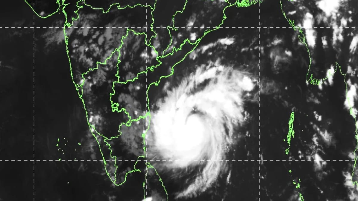
A developing low-pressure system in the Bay of Bengal is expected to intensify into a cyclonic storm by early November 2026. While coastal Andhra Pradesh faces heavy rainfall, the system is projected to weaken significantly before reaching inland areas like Telangana.
Meteorological Shift: New Cyclonic Threat in the Bay of Bengal
The India Meteorological Department (IMD) has issued a significant weather alert regarding a low-pressure area currently forming over the South Andaman Sea. This system, which is rapidly evolving, is expected to intensify into a depression and subsequently into a cyclonic storm by November 1, 2026. This development marks a critical period for weather monitoring in the region, particularly as it follows closely on the heels of previous cyclonic activity, including the system referred to as Cyclone Arnab.
Trajectory and Intensity Projections
According to the latest IMD data, the system is tracking in a west-northwestward direction. Forecasters anticipate the storm will reach the west-central Bay of Bengal, specifically nearing the Andhra Pradesh coast, by the evening of November 2. The transition from a well-marked low-pressure area to a cyclonic storm within a 24-hour window highlights the volatile atmospheric conditions currently present over the Bay of Bengal.
Impact on Coastal and Inland Regions
Coastal Andhra Pradesh is bracing for significant heavy rainfall as the storm approaches. The influence of this weather system is expected to extend beyond the immediate coast, with rainfall activity forecasted to resume in Kerala starting November 1. This resurgence of rain serves as a vital transition following a brief period of dry weather in the state, demonstrating the wide-reaching impact of Bay of Bengal disturbances on the Southern Peninsula.
Regional Variations in Weather Severity
While the threat is potent, the impact will not be uniform across the region. S. Stella, Head of the IMD Centre in Hyderabad, has clarified that the system is expected to lose considerable intensity as it moves inland. By the time the system reaches Telangana, it is projected to have weakened into a deep depression. Consequently, while coastal areas must remain on high alert for severe conditions, inland regions like Telangana are expected to experience a much milder meteorological profile.
Broader Implications and Future Trends
The recurring nature of cyclonic formations in the Bay of Bengal during this season emphasizes the importance of robust disaster management and early warning systems. The IMD's precise tracking—from the Andaman and Nicobar Islands towards the Andhra Pradesh coast—is essential for mitigating risk. As these systems continue to evolve, the ability to forecast the weakening of storms as they move inland is crucial for local authorities to manage public expectations and emergency responses effectively.
Conclusion
In summary, the meteorological situation remains fluid but well-documented. With the storm projected to cross the Andhra Pradesh coast on the morning of November 3, the focus remains on the intensity of rainfall and the potential for flooding in coastal corridors. By monitoring the system’s decay as it progresses inland, officials can better prepare for the localized weather changes that will characterize the first week of November 2026.
Multiple Citing Sources
Verification Required?