Heavy rain lashes Puducherry
Source Entity
India Latest News: Top National Headlines Today & Breaking News | The Hindu
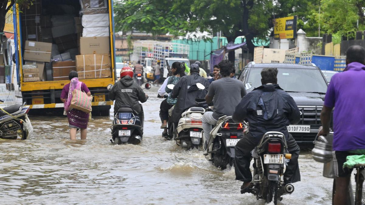
A depression over the Bay of Bengal has intensified, triggering cyclone warnings across nine ports in Tamil Nadu and Puducherry. The system is expected to strengthen into a severe cyclonic storm, with projected landfall on the Andhra Pradesh coast by October 28.
Cyclone Alert: Bay of Bengal Depression Intensifies
A significant meteorological event is unfolding in the Bay of Bengal as a low-pressure system has officially intensified into a depression. This development has prompted the India Meteorological Department (IMD) to issue urgent warnings, signaling that the system is on a trajectory to strengthen into a very severe cyclonic storm. The potential for widespread impact has put coastal regions on high alert, with authorities taking proactive measures to mitigate damage.
Port Warnings and Maritime Safety
As a direct response to the escalating threat, cyclone warning signals have been hoisted at nine key ports across Tamil Nadu and Puducherry, including Chennai, Nagapattinam, Cuddalore, Karaikal, Pamban, and Thoothukudi. These signals serve as a critical communication tool for maritime authorities and shipping vessels, indicating that high-risk weather conditions are imminent. In Puducherry specifically, a distant cautionary signal No. 1 has been raised, and fishing communities have been strictly advised to remain off the seas to ensure their safety.
Impact on Puducherry: Inundation and Infrastructure
The impact is already visible on the ground. Heavy, persistent rainfall lashed Puducherry, recording 9.7 cm between late Saturday and Sunday morning. The intensity of the precipitation has overwhelmed local infrastructure, leading to significant waterlogging in low-lying areas such as Boomianpet, Krishna Nagar, and Venkata Nagar. Major transit points like the Indira Gandhi Square and the East Coast Road junctions have experienced severe inundation, causing substantial disruptions to vehicular movement.
Urban Challenges and Public Safety
The current weather pattern has caused rainwater to surge through critical stormwater networks, including the Grand Canal and Uppanar. This has resulted in the flooding of residential properties, forcing many residents to remain indoors. The disruption extends to the commercial sector as well, with vendors at the iconic Sunday Market on Mahatma Gandhi Road struggling against the elements. The situation highlights the vulnerability of urban drainage systems when faced with extreme weather events characteristic of the post-monsoon period in this region.
Future Trajectory and Regional Risks
The IMD’s forecast suggests that the depression will continue to gain strength as it moves across the Bay of Bengal. The current projections indicate a landfall along the Andhra Pradesh coast on October 28. This upcoming phase is critical, as the transition from a depression to a very severe cyclonic storm involves significant increases in wind speed and storm surge potential. Authorities in both Andhra Pradesh and the already affected Tamil Nadu/Puducherry corridor remain in a state of heightened readiness.
Conclusion: A Call for Continued Vigilance
The combination of localized flooding in Puducherry and the broader regional threat of a major cyclone underscores the volatility of the Bay of Bengal during this season. As the system moves toward its projected October 28 landfall, the focus remains on disaster preparedness and minimizing the risk to human life and property. Public cooperation with local authorities and adherence to maritime safety protocols will be essential in navigating the coming days of extreme weather.
Verification Required?