Very severe cyclonic storm ‘Arnab’ begins landfall near Narsapur; Vizag battered by rain
Source Entity
India Latest News: Top National Headlines Today & Breaking News | The Hindu
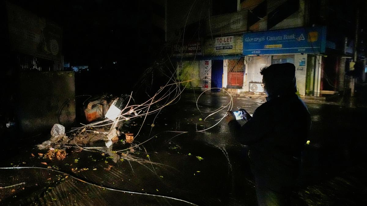
Cyclone Arnab has made landfall on the Andhra Pradesh coast, bringing destructive winds and torrential rain to districts like Kakinada and West Godavari. The India Meteorological Department had tracked the system's intensification from a low-pressure area to a severe cyclonic storm over several days.
The Progression and Impact of Cyclone Arnab
The India Meteorological Department (IMD) initially identified a low-pressure area over the east-central and southeast Bay of Bengal, which served as the precursor to a significant weather event. Over several days, this system underwent a structured intensification process, evolving from a simple low-pressure area into a depression on October 24, followed by a deep depression on October 25, and eventually a cyclonic storm by the morning of October 26.
Meteorological Projections and Warnings
As the system moved west-northwest towards the coast, meteorologists, including K. Naga Ratna of the Amaravati Meteorological Centre, highlighted the severity of the impending storm. The IMD issued red warnings for coastal Andhra Pradesh and parts of Odisha, anticipating extremely heavy rainfall between October 27 and 29. Initial forecasts suggested the system would reach at least severe cyclonic status, with some models predicting wind speeds reaching up to 145 kmph and potential storm surges of 1 to 2 metres.
Landfall and Immediate Consequences
Cyclone Arnab officially made landfall on the Andhra Pradesh coast between Kakinada and Yanam on Wednesday. The impact was immediate and destructive, with gusty winds clocked between 125 and 135 kmph. Regions including Kakinada, Konaseema, and West Godavari bore the brunt of the storm, experiencing widespread disruption to power supplies and significant damage to local infrastructure, including the uprooting of trees.
Disaster Management and Emergency Response
Authorities, led by the AP State Disaster Management Authority, monitored the situation closely as the landfall process began Tuesday night. As of Wednesday morning, officials reported that the 'eye' of the storm was approximately 30km from Narsapuram. The proactive measures taken by the IMD, such as issuing timely sea warnings and advising fishermen to return to shore, were critical in mitigating potential human casualties during this high-intensity event.
Broader Implications and Future Trends
The formation of cyclones in the Bay of Bengal during this post-monsoon window remains a recurring challenge for the coastal regions of Andhra Pradesh and Odisha. The rapid intensification of this specific system underscores the increasing need for advanced meteorological modeling and robust disaster preparedness infrastructure. As climate patterns shift, the frequency and intensity of such storms continue to necessitate stringent adherence to IMD protocols and effective state-level disaster management coordination to protect lives and livelihoods along the coast.
Multiple Citing Sources
Verification Required?