Low pressure over Bay of Bengal likely to turn into cyclonic storm, landfall expected on Oct. 28
Source Entity
India Latest News: Top National Headlines Today & Breaking News | The Hindu
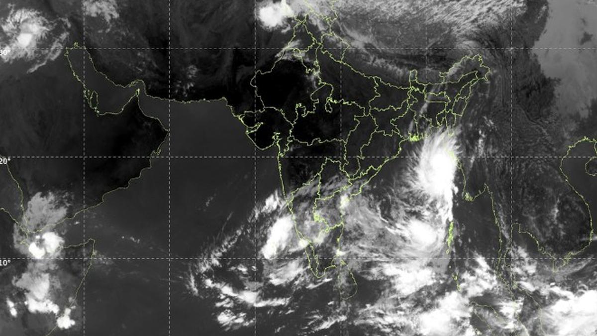
The India Meteorological Department has issued warnings for a developing cyclonic storm in the Bay of Bengal expected to hit the Andhra Pradesh and Odisha coasts by October 28. The system is forecasted to bring extreme rainfall to these states and parts of Telangana, potentially alleviating drought conditions.
Impending Cyclonic Threat: Bay of Bengal Weather System
The India Meteorological Department (IMD) has officially flagged the formation of a low-pressure system over the east-central and southeast Bay of Bengal, which is projected to intensify rapidly. According to official reports, this system is expected to evolve into a depression by October 24, a deep depression by October 25, and a full-scale cyclonic storm by the morning of October 26. This meteorological progression highlights the volatile nature of the Bay of Bengal during the post-monsoon season.
Projected Path and Intensity
Meteorological experts, including K. Naga Ratna of the Amaravati Meteorological Centre, have indicated that the storm is tracking west-northwest toward the North Andhra Pradesh and South Odisha coasts. The system is anticipated to make landfall in the early hours of October 28. Projections suggest the storm could reach the intensity of a severe cyclonic storm, with some models warning it could escalate into a very severe cyclonic storm, carrying wind speeds reaching 145 kmph and generating a storm surge of 1 to 2 meters.
Impact on Coastal Regions
Coastal Andhra Pradesh and Odisha are under high-alert status, with the IMD projecting extremely heavy rainfall between October 27 and 29. Authorities have issued urgent advisories for fishermen currently at sea to return to the shore immediately, as maritime conditions are expected to deteriorate rapidly. The combination of intense wind speeds and storm surges poses a significant threat to infrastructure and coastal settlements in the projected path.
Drought Relief and Rainfall in Telangana
While the cyclone poses significant risks, there is a silver lining for the drought-hit state of Telangana. The state has been suffering from a rainfall deficit exacerbated by El Niño conditions, which have negatively impacted water availability. The incoming weather system is expected to bring heavy to very heavy rainfall to districts including Mulugu, Bhadradri Kothagudem, and Khammam. A red alert has been issued for these specific areas, while Hyderabad is anticipated to receive moderate rainfall.
Broader Implications and Future Trends
The development of this storm underscores the increasing frequency and intensity of cyclonic activity in the Bay of Bengal. As the region navigates the complexities of changing climate patterns, the reliance on precise IMD forecasting becomes paramount for disaster mitigation. The dual nature of this event—presenting both a destructive threat to coastal regions and a necessary relief for drought-impacted inland areas—reflects the complex environmental challenges faced by the Indian subcontinent.
Concluding Outlook
As the storm approaches, the focus remains on real-time monitoring and public safety. Residents in Andhra Pradesh, Odisha, and Telangana are advised to adhere to government warnings as the system crosses the coast. The coming days will be critical in determining the final severity of the storm and the extent to which the anticipated rainfall will help stabilize the water crisis in the hinterlands.
Multiple Citing Sources
Verification Required?