Over 8 Lakh Left Without Power In 3 States As Hurricane Makes Landfall In US
Source Entity
NDTV News Search Records Found 1000
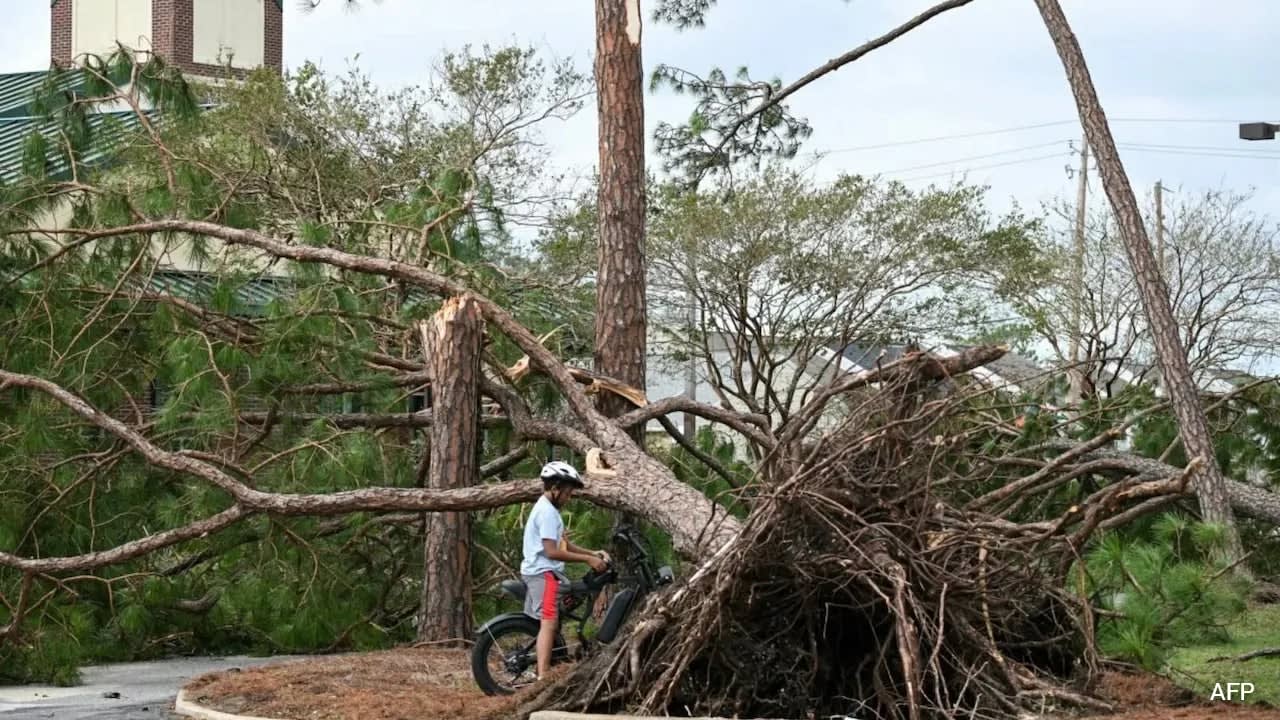
Hurricane Isaias has intensified into a major Category 3 storm, threatening the U.S. Gulf Coast with life-threatening winds and flooding. It marks the first hurricane of a notably quiet 2026 Atlantic season, with landfall expected Friday night between Alabama and the Florida Panhandle.
The Emergence of Hurricane Isaias: A Rare 2026 Atlantic Event
Hurricane Isaias has rapidly intensified, evolving from an initial Category 1 storm with 80 mph winds into a formidable Category 3 major hurricane. As of the latest National Hurricane Center (NHC) updates, the storm is packing maximum sustained winds of 115 mph and is moving north at approximately 17 mph. Currently positioned about 90 miles south of Pensacola, Florida, Isaias is on a direct collision course with the northern Gulf Coast, with landfall anticipated between Mobile Bay, Alabama, and Destin, Florida, on the evening of Friday, October 9, 2026.
Historical Context of the 2026 Season
This development is historically significant due to the unusual delay in the formation of the season's first hurricane. According to the National Oceanic and Atmospheric Administration (NOAA), the Atlantic basin has experienced a notably quiet season, largely attributed to the influence of a strong El Niño. The emergence of a first hurricane this late in the calendar year has not occurred since October 8, 1905. This rare timing underscores the anomaly of the 2026 season compared to modern meteorological trends observed during the satellite era.
Anticipated Impacts on the Gulf Coast
Residents across the Florida Panhandle and Alabama coast are bracing for a multi-faceted threat. Local authorities have issued warnings regarding destructive wind speeds and significant storm surges, which pose life-threatening risks to coastal communities. Furthermore, meteorologists are forecasting heavy rainfall ranging from 75-150mm (2.9-5.9in), with localized areas potentially receiving up to 250mm. The combination of intense wind and saturation increases the likelihood of widespread power outages and potential tornado activity.
Emergency Preparedness and Public Response
The rapid escalation of Isaias has prompted immediate action from residents in vulnerable areas, including Pensacola and Fort Walton Beach. Homeowners have been observed securing property, filling water supplies, and preparing backup power sources like generators. As conditions deteriorate rapidly, the focus has shifted toward final preparations and adherence to local evacuation orders, as officials emphasize that the storm's transition to a major hurricane status significantly elevates the danger profile for anyone remaining in the landfall zone.
Future Trends and Inland Reach
While the immediate danger is concentrated on the coast, the impact of Isaias is expected to extend well inland. Forecasters predict that the storm will continue to deliver strong winds and heavy rain as it moves north, with potential effects reaching as far as Atlanta. Once the system makes landfall and interacts with land, it is expected to gradually lose steam; however, the initial force of a Category 3 hurricane ensures that the risk of flooding and structural damage will persist for several hours after the center of the storm crosses the coastline.
Conclusion
Hurricane Isaias serves as a stark reminder of the volatility of Atlantic weather patterns, even in a season defined by its initial lack of activity. By reaching major hurricane status late in the season, it has defied expectations and forced a high-stakes emergency response along the U.S. Gulf Coast. The coming hours will be critical as communities face the brunt of this powerful system, highlighting the ongoing necessity for robust disaster preparedness in the face of unpredictable climate events.
Multiple Citing Sources
Verification Required?