Make Your First Edit to OpenStreetMap in the Next 15 Minutes
Source Entity
Hacker News
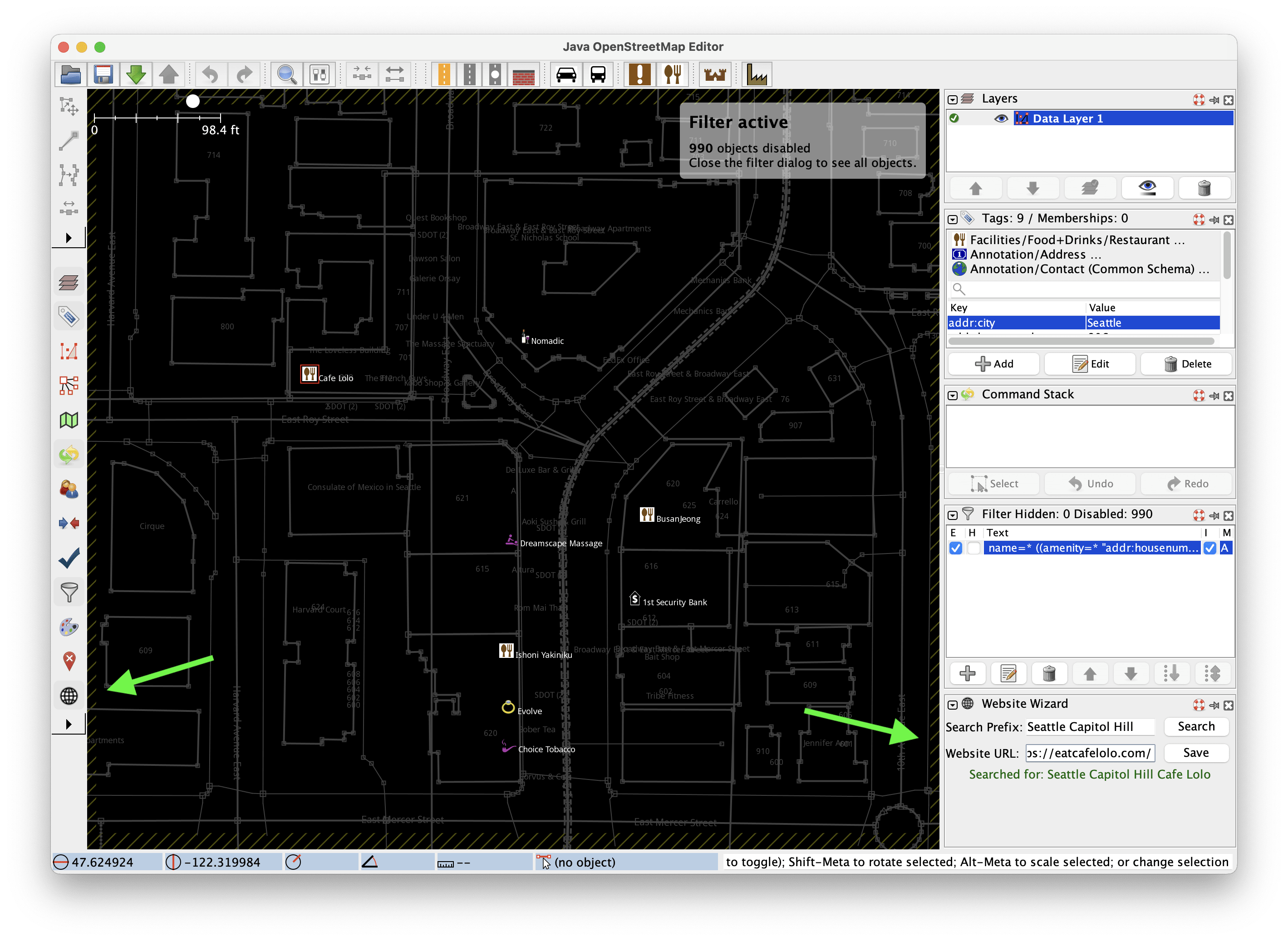
OpenStreetMap is inviting new contributors to participate in a 15-minute tutorial focused on adding website tags to local amenities. This initiative aims to improve global map data accuracy by crowdsourcing essential business information.
Empowering Global Mapping Through Crowdsourcing
OpenStreetMap (OSM) functions as a collaborative, free, and editable map of the world, relying entirely on the contributions of volunteers to maintain its comprehensive database. The recent initiative to guide new users through their first edit—specifically adding a website tag to a local shop or amenity—serves as a strategic entry point for community growth. By simplifying the onboarding process into a 15-minute task, OSM lowers the barrier to entry for individuals who may feel overwhelmed by the technical complexity of geographic data contribution.
The Strategic Importance of the Website Tag
The choice to focus on website tags is rooted in data efficiency. When a contributor adds a website link to a specific location in OSM, they are effectively creating a 'hub' of verified metadata. Most official business websites contain a wealth of secondary information, such as phone numbers, current opening hours, and email addresses. By seeding the map with a URL, contributors provide a verifiable source that allows other mappers and automated systems to populate the map with more granular detail, ultimately increasing the utility of the geographic record.
Integrating Data into Global Services
The impact of a single edit in OpenStreetMap is far-reaching. Once a piece of data is ingested into the OSM database, it becomes instantly available to dozens of free, third-party services that rely on this open-source infrastructure. From navigation apps and logistics platforms to humanitarian relief tools, the ripple effect of one user adding a website tag ensures that real-world entities are accurately represented, helping people worldwide find and interact with local services more effectively.
Lowering Technical Barriers
The technical workflow outlined for new users involves creating an OSM account and utilizing JOSM, a professional-grade Java-based editor. While JOSM is a powerful tool requiring a download of approximately 365 MB, the tutorial format suggests a concerted effort by the OSM community to demystify these tools for beginners. By providing a clear, step-by-step path, the project hopes to transform casual users into consistent contributors, fostering a sustainable ecosystem of data maintenance.
Broader Implications for Digital Infrastructure
As digital maps become an essential utility for modern life, the reliance on crowdsourced data like OSM has become a critical alternative to proprietary mapping services. The ability for a community to self-correct and update information in real-time ensures that the map reflects the dynamic nature of local economies. This initiative highlights the ongoing trend where the collective effort of individual users creates a robust, public-domain digital commons that rivals corporate-owned geographic databases in both quality and scope.
Future Trends in Community Mapping
Looking forward, the success of such micro-tasks suggests that the future of mapping lies in gamification and incremental updates. By breaking down the daunting task of mapping a city into manageable, 15-minute contributions, OpenStreetMap is positioning itself to scale its operations globally. If the project continues to emphasize these bite-sized interactions, it will likely see a surge in participation, further cementing its role as the backbone of open-source geospatial intelligence.