Sky Map 2000 – Star Atlas and Planetarium
Source Entity
Hacker News
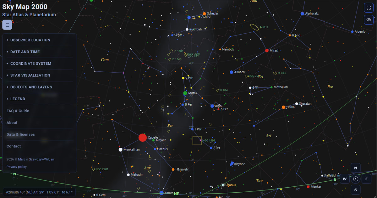
Sky Map 2000 is a digital star atlas that uses precise geographic coordinates to calculate celestial body positions. It prioritizes user privacy by processing location data locally within the browser.
Understanding the Sky Map 2000 Celestial Platform
Sky Map 2000 functions as a sophisticated digital star atlas and planetarium tool designed for amateur and professional astronomers. By utilizing precise geographic coordinates, the platform calculates the local horizon and celestial meridian, allowing users to visualize the sky as it appears from their specific position on Earth. This level of computational accuracy is essential for determining the altitude and azimuth of celestial bodies, which are the fundamental metrics for tracking objects in the night sky.
Precision Through Geographic Coordinates
The utility of Sky Map 2000 hinges on its ability to translate latitude (φ) and longitude (λ) into a localized view of the cosmos. Because the Earth is a sphere, the visible portion of the celestial sphere shifts depending on one's location. The software simplifies this complex geometry by allowing users to select their vantage point via an integrated catalogue of global cities and capitals. By automating these calculations, the tool bridges the gap between complex observational astronomy and accessible user interfaces.
Privacy and Data Security
A standout feature of this software is its commitment to user privacy. Unlike many modern web applications that rely on external location-search services, Sky Map 2000 runs its city catalogue entirely within the user's browser. This means that search queries and coordinate data are not transmitted to external servers. This design choice is particularly significant in an era where geographic data is frequently harvested, offering a secure environment for hobbyists to explore the heavens without compromising their digital footprint.
Limitations and Observational Realities
While the software provides high-level mathematical accuracy regarding celestial positioning, it is important to note its inherent limitations. The developers explicitly state that external environmental factors—specifically weather, local terrain, and light pollution—are not factored into the visual output. Users must therefore supplement the digital data provided by Sky Map 2000 with real-world observations regarding cloud cover and urban light interference, which are the primary obstacles to successful stargazing.
Future Trends in Digital Astronomy
The evolution of tools like Sky Map 2000 reflects a broader trend toward democratizing scientific observation. By moving complex astronomical calculations from specialized hardware to browser-based software, the barrier to entry for astronomy is significantly lowered. As these platforms continue to refine their interfaces and increase the depth of their celestial catalogues, we can expect to see even greater integration of real-time data, potentially offering users more predictive insights into astronomical events.
Conclusion
In summary, Sky Map 2000 represents a reliable and secure instrument for mapping the night sky. By focusing on computational precision and user privacy, it serves as an excellent resource for those looking to understand their local celestial horizon. While it requires the user to account for physical environmental variables, its ability to provide accurate astronomical data without the need for external location tracking makes it a valuable tool in the kit of any modern stargazer.