Yamuna floodplains shrank by a third in a century, study links it to higher flood risk
Source Entity
Sophiya Mathew
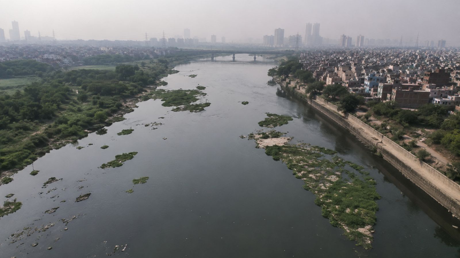
A study by DU and IISER Bhopal reveals that Delhi's Yamuna floodplains have shrunk by a third over the last century. Rapid urbanization and infrastructure projects have narrowed the river channel by 68%, significantly increasing flood vulnerability.
The Ecological Erosion of the Yamuna: A Century of Decline
Recent scientific research has brought to light a critical environmental crisis unfolding in the heart of India's capital. A comprehensive study published in April this year in the Journal of the Geological Society of India reveals a startling trend: the Yamuna River's floodplains have shrunk by approximately one-third over the course of a century. This research, conducted by experts from the University of Delhi (DU) and the Indian Institute of Science Education and Research (IISER), Bhopal, underscores a dangerous trajectory where natural river dynamics have been systematically dismantled by human intervention, leaving the city of Delhi increasingly vulnerable to catastrophic flooding.
The Mechanics of Channel Narrowing
One of the most alarming findings of the study is the sheer scale of physical constriction the river has faced. The researchers estimate that rapid urbanization has narrowed the Yamuna's channel by about 68%. This is not merely a loss of land but a fundamental alteration of the river's hydrology. By reducing the 'formative discharge'—the volume of water required to maintain the river's natural channel—the river has lost its capacity to self-regulate and sustain its own path. When a river's channel is constricted to this extent, it can no longer efficiently transport large volumes of water, leading to a higher likelihood of overflows during peak flow periods.
The Role of Anthropogenic Infrastructure
The study identifies a combination of barrages, embankments, and urban sprawl as the primary drivers of this degradation. Historically, rivers fluctuate seasonally, expanding into their floodplains during the monsoon to dissipate energy and deposit nutrient-rich silt. However, the construction of permanent embankments and barrages has effectively 'corseted' the Yamuna. While these structures were likely intended to protect urban areas or manage water levels, they have instead disrupted the natural seasonal flow. By preventing the river from expanding laterally, these interventions force the water to rise vertically, drastically increasing the risk of flash floods and prolonged inundation in low-lying urban zones.
Urbanization and the Loss of Natural Buffers
Beyond the engineered structures, the relentless pace of Delhi's urban expansion has played a decisive role. The conversion of floodplains into residential, commercial, or industrial zones has stripped the city of its natural sponge. Floodplains act as critical buffers that absorb excess rainwater; without them, the water has nowhere to go but into the streets and homes of the city. The reconstruction of the river's evolution using historical maps and satellite imagery proves that the current state of the Yamuna is a far cry from its natural historical state, illustrating a century-long pattern of encroachment that prioritizes concrete over ecological stability.
Future Implications and Flood Vulnerability
Looking forward, the implications of this shrinkage are severe. As climate change increases the frequency of extreme rainfall events, the Yamuna's reduced capacity to accommodate high flows becomes a ticking time bomb. The study suggests that the current infrastructure is insufficient to handle the volume of water during heavy rains because the natural safety valves—the floodplains—have been largely erased. Without a strategic shift toward restoring these floodplains or implementing 'room for the river' strategies, Delhi can expect more frequent and more severe flooding episodes that will likely result in greater economic loss and risk to human life.
Conclusion: A Call for Ecological Restoration
In summary, the findings from DU and IISER Bhopal provide a stark warning about the consequences of ignoring riverine ecology in urban planning. The loss of a third of the Yamuna's floodplains and a 68% reduction in channel width are not just statistics; they are indicators of a broken hydrological system. To mitigate the increasing flood risk, it is imperative that policymakers integrate historical geographical data and satellite imagery into future urban development plans, prioritizing the reclamation of the river's natural space to ensure the long-term resilience of the capital.